In this one I kick my own ass and it hurts.
Because winter backpacking in Coe went so well and we wanted to stay in shape for an upcoming trip, I found an overnight we could do close to home — and made sure it was super challenging in honor of Jordan’s birthday! This would be a portion of the Ohlone Wilderness Trail, done “the hard way” as the ranger said when I booked our campsite: 22 miles and more than 5,000 feet of elevation in two days.
Saturday
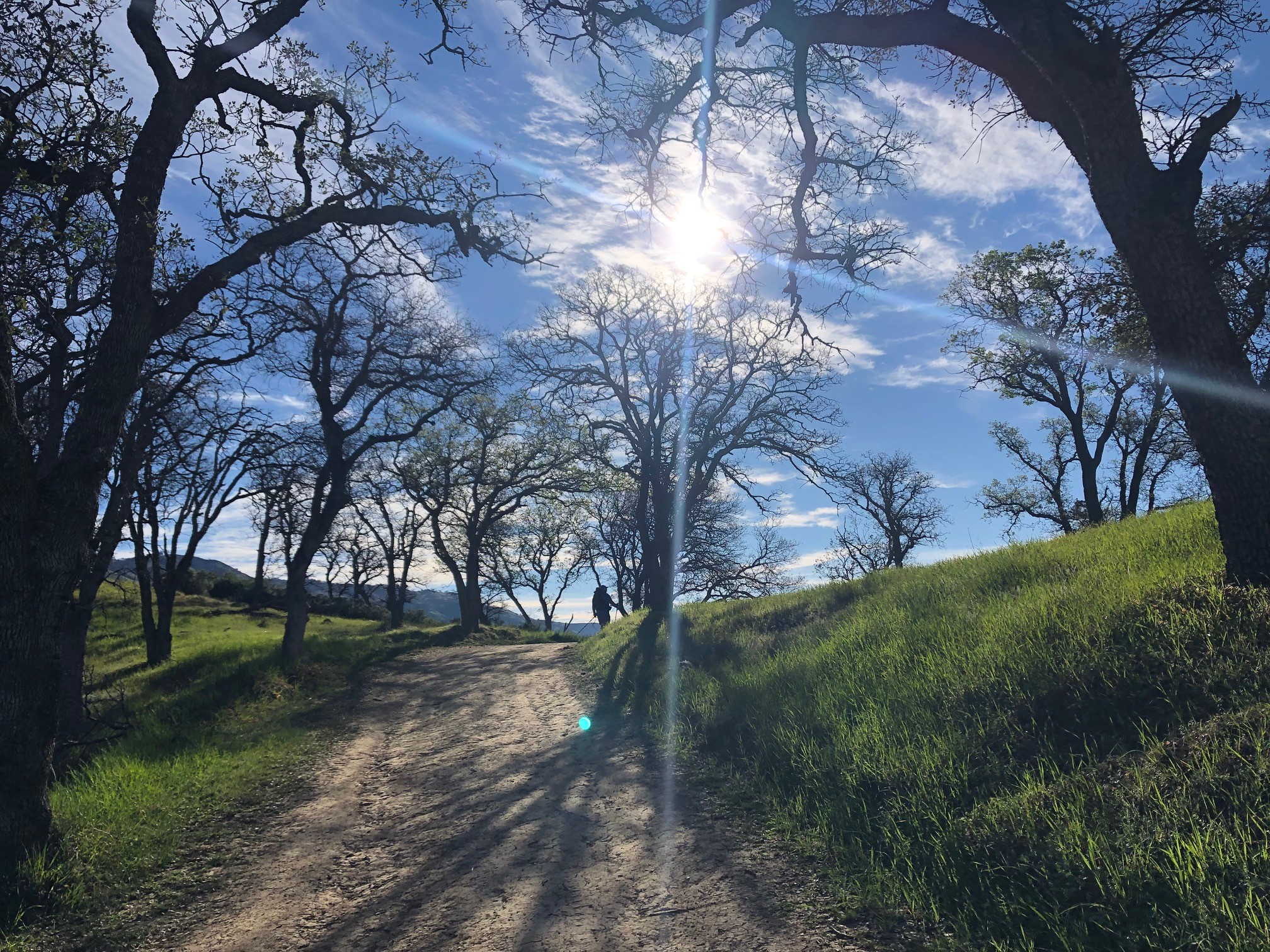
We did a great job getting up early and making it to the trailhead right around when the park opened at 9 a.m. Setting my alarm the night before required doing the only arithmetic I can really handle, which is: Since I hoped to not be racing sunset (before 6 p.m.!) to set up camp, I estimated 8 hours to hike 11 miles with 4,000 feet of gain. And we did do it at about that pace: victory for simple addition and division.
The trail began with a steady climb, gaining 1,700 feet over 2.5 miles. The great part about an out-and-back trail is that as you feel your quads on the way up, you can also rest easy knowing your knees will be aching on the way down the next day! This got us as far as Rocky Ridge and Boyd Camp, with a nice view of Lake del Valle and a water pump I tried and failed to use to moisten my handkerchief. (Later I learned it was actually broken, so my weak arms can’t fully be blamed.)

It wouldn’t be an East Bay park if we didn’t immediately lose 700 feet! We crossed a lovely little trickle of a stream, paused for just a bit and chatted with a fellow hiker resting in the shade, then started to ascend “The Big Burn.” That’s literally what it says on the map. Two miles gaining a painful 1,400 feet — cruelty, plain and simple. And of course there was less and less tree cover and more and more sun 🙂 While the last few hundred vertical feet were brutal, I really loved the rocks of Williams Gulch contrasted on the springy green. There were butterflies and wildflowers. Jordan was way ahead and I tried to not get in my head about it. It was a slog.
At last we made it to Schlieper Rock, about 5 miles and 2,800 feet gained in, and it was LUNCHTIME. We took our packs and boots off (my shirt, too) and really relished the moment, knowing we still, somehow, had 7 miles and oh, I don’t know, a couple hundred feet here and there to lose and gain before camp (in fact, we had one-third of our elevation gain to go LOL). This rock is named for a silversmith who worked at Rowell Ranch; they scattered his ashes here in the ’50s and then stuck a plaque on it.

Our next stop would be Murietta Falls: a detour on the way to Rose Peak, but I knew I wasn’t going to want to tackle it on Sunday when a comfy couch and elderly cat were waiting for me. We had plennnnty of daylight left, too, so we took the turn down, then up, then down, then up again to visit Murietta Falls. I LOVED these rocks that seemed to bubble up out of the grass.

This is the creek that becomes Murietta Falls: we walked over it, then dropped our packs and hiked down toward the bottom. I do not have pictures because my phone was still in my pack and my legs hurt way too much to go back up there but Jordan took one a few weeks later on another trip (he’s nuts) and here it is:
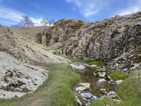
This area is described by some as a “remote, rocky slit” and that is about right. The rocks are much more amazing than a bunch of water would be, in my opinion (though maybe if it had more I’d change my tune). The grass and lichen and rocks reminded me of Iceland. Some people do this as a day hike and I salute them. On our way back to the OWT we passed some hikers at Stewart’s Camp and refilled our water. I think that was lucky because they couldn’t really figure out how to use the water spigot and we showed them how. I remarked once we were out of earshot that that campsite looked unappealing: too close to a buggy little pond, shady and chilly. Good thing we were heading to the next camp!

Well, after this the hike became a real slog for me. I know I said that it was earlier but I didn’t mean it: THIS was when I bonked. I hadn’t eaten enough (something I always struggle with on trail), and we were getting thirsty to get to camp and be done for the day. Our elevation at any point wasn’t far from the camp elevation at 3,400 — but the trail was “rollicking,” in the memorable (understated!) word once employed by the great Jane Huber to describe another cruel East Bay trail and which friends and I will never ever ever forget.
At one point I crested a ridge, looked at my GPS, saw that the camp was on the NEXT ridge, looked DOWN at the trail ahead, knew I’d have to go down it and up again, and something in me broke. I yelled and sobbed (amazing that I had energy for it?!) and at one point sat down on the trail figuring I wouldn’t move anymore. Eventually I got up and dragged my ass to camp at Maggie’s Half Acre. Not much more to say about how that went but basically it was slow and it was ugly.

Once we were at camp I drank a bunch of water, ate dinner and instantly felt better. I asked Jordan to help me deal with this in the future by reminding me to eat something. We’ll see how that goes!
Our site wasn’t particularly scenic, and it was chilly (still I bet Stewart’s was worse), so we went to bed fairly soon after sunset. The frogs at a pond behind the privy went nuts, and through the night planes flew overhead. I slept well and long, and stayed warm and there’s not much more you can ask for.
Sunday
Cock-a-doodle-do! What better way to start the day than WALKING UPHILL? You can see how much I loved the breeze at the top of Rose Peak, at 3,816 feet. It’s just 33 feet lower than that bossy queen of the Bay Area skyline, Mt. Diablo.

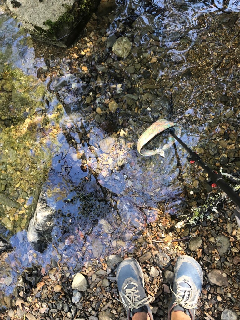
A lot of the day was hiking downhill, which has its own pains, and plenty of uphill. This time we didn’t have another opportunity for water until we were nearly at the bottom, so I chugged all I could at breakfast then tried to be parsimonious with my two liters. We passed almost everything we’d seen the day before but in reverse: La Costa Creek, Blue Rock, Johnny’s Pond, an old pear orchard wracked by mistletoe, and then had an early lunch again at that rock. When we crossed the creek at the bottom of the Big Burn (oh my poor sainted knees!) I stopped to moisten the kerchief for my head. Bless.
The last few miles were tough. All downhill, but so steep, and so close yet so far to the car, within it a different pair of shoes and air conditioning. Jordan ran down mostly but I was too scared to twist something. At last we made it to the trailhead, and our car, and changed and drove to some sort of place that sells food. The next day I started to plan my next backpacking trip.
Lighterpack: his and hers
Lessons learned: Pause and eat. – Miranda
Ask Miranda to eat something before she starts sobbing. – Jordan

1 Comment